


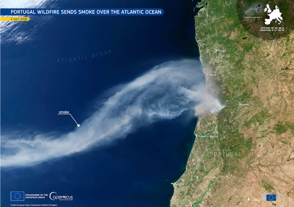
According to a statement by Copernicus, the image was captured by one of its Sentinel-3 satellites at 11.38am (Portugal time) on 3 July, during a period when several wildfires were burning throughout northwestern Portugal.
“The Copernicus satellite images support wildfire monitoring by providing information on the location of active fires and environmental conditions, helping authorities assess the situation and coordinate their response”, said the agency.
Copernicus noted that more than 1,100 firefighters were deployed to tackle the blaze at Vouzela, in the Viseu district, while additional fires were also reported in Barcelos, Cinfães and Castelo de Paiva.
Although the Vouzela wildfire was brought under control on Sunday, 5 July, emergency services maintained a strong presence on Monday morning amid concerns over possible flare-ups. By 7.30am, 742 firefighters and 253 vehicles remained at the scene.
The National Authority for Emergency and Civil Protection also reported that across mainland Portugal, 1,074 operational personnel and 356 vehicles were responding to 19 separate incidents simultaneously.
Meanwhile, the Portuguese Institute for Sea and Atmosphere (IPMA) warned that persistent high temperatures continue to leave much of the country at significant risk of wildfire, as more than 100 municipalities throughout the northern and central interior were classified as facing maximum rural fire danger, alongside ten municipalities in the districts of Évora, Beja and Faro.








 English
 Nederlands
 Deutsch
 Français
 Español
 Italiano
 Svenska
 Pусский
 中文
中文 Türkçe
 Português
 Polski
 عربي
عربي Suomi
Suomi עִברִית
 Português (Brasil)
Follow us on social media